
Tasmania Port Guides
- Dec 2, 2015
- 1 min read
CompAIS is researching and compiling data on various Australian ports as a guide for our staff, and clients. Please be aware, this data is a visual guide only and is not to be used for navigation purposes. Where possible, the photos have been taken from inside each port and at low tide to provide a view of bar crossings and navigational aids. For more marina information visit www.marinasguide.com.au
DEVONPORT
Devonport Screenshot from Garmin Mapsource for a guide only. (Not for Navigation)

Devonport Harbour

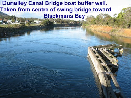
DUNALLEY CANAL
Dunalley Screenshot from Garmin Mapsource for a guide only. (Not for Navigation)

Dunalley Canal
Dunalley bridge

Dunalley canal - Blackmans Bay

Dunalley Bay

GEORGETOWN - TAMAR RIVER
Georgetown Screenshot from Mapsource as a guide only. (Not for Navigation)

Tamar River

LAUNCESTON
Launceston Screenshot from Mapsource for guide only. (Not for navigation)

Seaport Marina Launceston

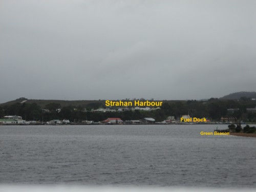
MAQUARIE HARBOUR
Maquarie Harbour Screenshot from Mapsource for use as aguide only. (Not for Navigation)

Hells Gate INBOUND

Maquarie harbour entrance

Strahan Fuel Dock

Strahan Harbour INBOUND
PORT ARTHUR
Port Arthur Screenshot from Mapsource for use as a guide only. (Not for Navigation)

Port Arthur

PORT SORELL
Port Sorell screenshot from Mapsource for use as a guide only. (Not for Navigation)

Port Sorell. On the leads seaward bound

SMITHTON
Smithton Screenshot from Mapsource for use as a guide only. (Not for Navigation)

From Smithton Wharf

ULVERSTONE
Ulverstone Screenshot form Mapsource to be used as a guide only. (Not for Navigation)

Ulverstone

WYNYARD
Wynyard Screenshot from Mapsource to be used as a guide only. (Not for Navigation)

Wynyard from Park and Jetty
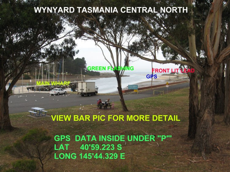
Wynyard Bar and Leads


Comments